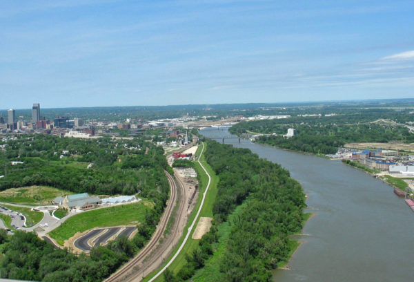
The Missouri River is one of the most historically-significant, useful and powerful of our nations major rivers. The longest river in North America, it begins its flow in the Rocky Mountains of western Montana and flows east and south for 2,540 miles before entering the Mississippi River north of St. Louis, Missouri. The river takes drainage from a watershed of more than half a million square miles including parts of ten U.S. states and two Canadian provinces.
During the 20th century, the Missouri River Basin was extensively developed for irrigation, flood control and the generation of hydroelectric power. Fifteen dams impound the main stem of the river, with hundreds more on tributaries.
One hundred and fifty-one miles of the Missouri River form the eastern boundary of the six counties that comprise the Papio-Missouri River NRD and offers significant flood control challenges – as illustrated by historical flooding in 2011 throughout the Missouri River Basin.
Missouri River Levees R-613 and R-616
Click Here for area map
The NRD operates and maintains over 16 miles of levees along the Missouri River and Papillion Creek in southeast Sarpy County, Nebraska. These vital flood protection structures protect homes, agricultural land, businesses, the Omaha Wastewater Treatment Plant and, of national importance, Offutt Airforce Base/STRATCOM.
Missouri River Levee R-613, a component of the Missouri River Levee System Project, was authorized as part of the Flood Control Act of 1944 (Pick-Sloan Plan). The federal levee, constructed by the U.S. Army Corps of Engineers, is located in southeastern Sarpy County adjacent to the Platte River, Missouri River, and Papillion Creek. The District serves as local sponsor and has operation and maintenance responsibility for the thirteen-mile levee.
Missouri River Levee R-616 is the right bank levee along the Missouri River from the mouth of the Papillion Creek north to Highway 370 in Bellevue. This 5-mile long federal levee, also constructed by the Corps of Engineers, provides flood protection from high flows on the Missouri River and Papillion Creek for the area east and south of Bellevue. The NRD also serves as local sponsor of this levee.
In 2010, the District began the process of accreditation of the R-613 and R616 Levees for inclusion in the updated Digital Flood Insurance Rate Map (DFIRM) to be published by FEMA in the next few years. Accreditation will involve the evaluation of the levee , design of modifications to meet FEMA criteria, and construction of those improvements. Construction activities may begin in 2017.
For More Information contact:
Paul Woodward
Groundwater Management Engineer
pwoodward@papionrd.org
402-315-1772
Epic Flood of 2011
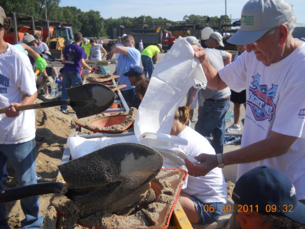
The summer of 2011 brought extraordinary Missouri River flooding to much of the Papio-Missouri River NRD area. In Sarpy County, Levees R-613 and R616 withstood more than three months of extremely high Missouri River floodwater. NRD flood fighting crews were joined by the Ne. National Guard, Americorps volunteers, Offutt Air Force Base personnel and many other local volunteers to offer 24-hour levee surveillance and to work with the U.S. Army Corps of Engineers to bolster the levees in areas threatened by flood water seepage to landward areas.
Operation and Maintenance
All flood control structures require continuing maintenance to remain safe and effective. Unbridled flood waters possess a destructive power unmatched by other forces in nature. Containing high water flows can best be accomplished with often-inspected, well maintained flood control structures. Our crews now inspect and maintain over 80 miles of flood control improvements throughout our six-county area.
For More Information contact:
Martin Cleveland
Construction and Maintenance Engineer
402-444-6222
mcleveland@papionrd.org
Floodway Purchase
The Floodway Purchase program, begun in 1990, reduces future flood damage through the purchase of land and property from willing sellers. This effort has already been highly successful in removing flood-prone buildings along the Missouri River south of Bellevue, NE. Once structures have been removed, the area is allowed to return to its natural floodplain functions. Over 100 structures along the Missouri River in Sarpy County have been removed.
For More Information contact:
Amanda Grint
Water Resources Engineer
402-444-6222
agrint@papionrd.org


