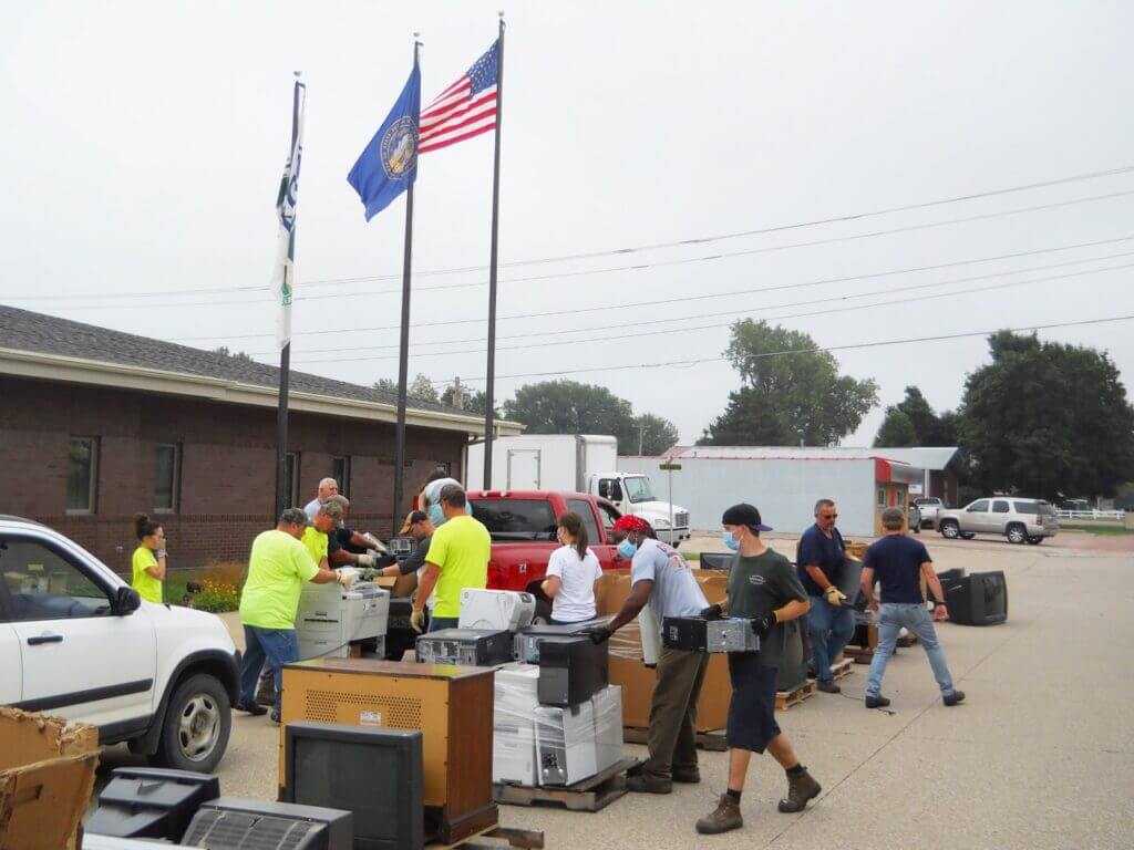
A total of 177 vehicles – a record turnout – participated in the scrap electronics collection held recently at the USDA Service Center in Dakota City.
Papio-Missouri River Natural Resources District (NRD), USDA Natural Resources Conservation Service (NRCS) staff, Nebraska Loess Hills Resource Conservation & Development Council (RC&D) members, and other community volunteers assisted with half-day event.
Other collections were also held in the communities of Walthill, Tekamah, and Blair. The collections were free of charge to local Nebraska residents and businesses. Funding was provided through the Litter Reduction and Recycling Incentive Grant, the Nebraska Department of Environment and Energy (NDEE) and Papio-Missouri River NRD. Midwest Electronic Recovery of Clive, Iowa, was the disposal contractor and is only one of a few companies certified for destruction and recycling of banking, medical/hospital, and governmental agency information.
Flights to Collect Data About Groundwater Aquifers
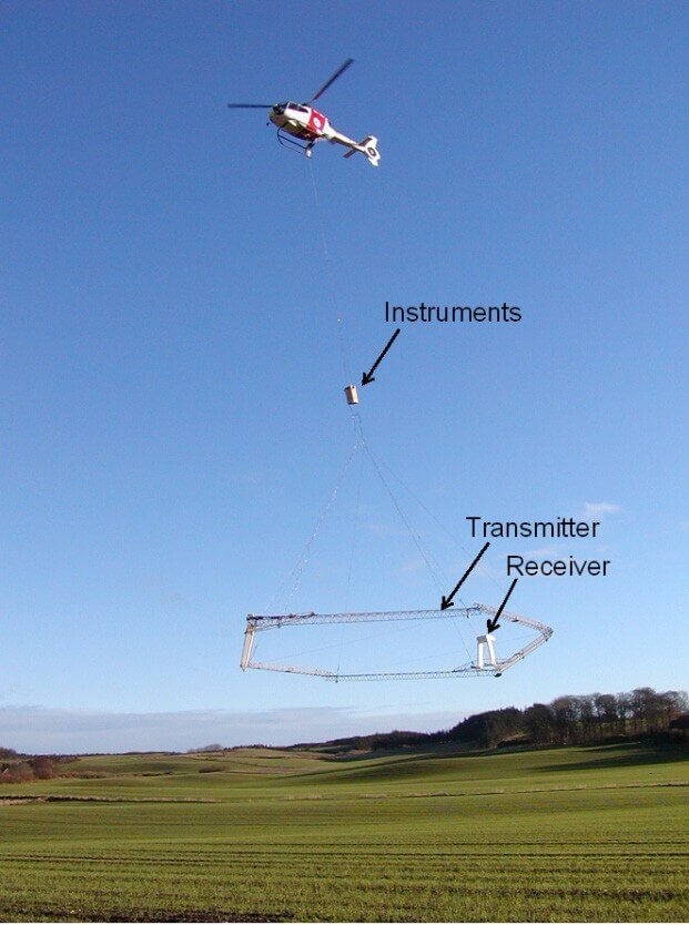
Data-collecting helicopter equipment
Eastern Nebraska residents should not be alarmed if they see a low-flying helicopter over areas of the Papio-Missouri River Natural Resources District in August.
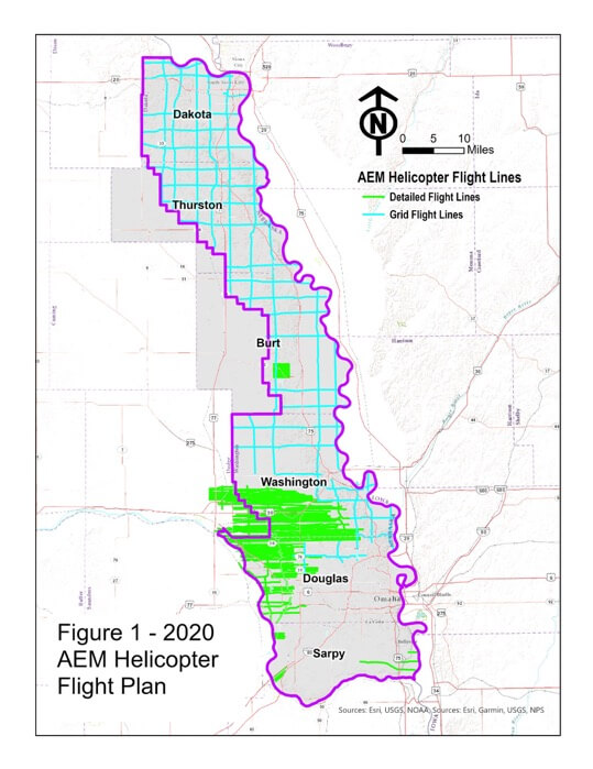
Beginning August 1st and lasting approximately three weeks, instruments mounted below a helicopter will collect and record geologic measurements to learn more about groundwater aquifers in Dakota, Thurston, Burt, Washington, Douglas, Dodge and Sarpy Counties. The Papio NRD, as part of the Eastern Nebraska Water Resources Assessment, have planned the flights and are completing them with financial assistance from the Nebraska Water Sustainability Fund, through the Nebraska Natural Resources Commission. A flight schedule for each area is forthcoming.
“The flights will improve our understanding of available groundwater and its possible connections with surface water in an area of the state made more complex by the presence of glacial deposits,” said Paul Woodward, Groundwater Management Engineer for the Papio NRD.
Aqua Geo Frameworks (AGF), of Mitchell, Nebraska will oversee the flights, process data and produce a final report. The equipment can collect data at a speed of more than 50 miles per hour and explore to a depth of more than 700 feet below the ground surface. Scientific equipment, that looks like a hexagon, is towed about 100 feet below the helicopter in a ‘spider web’ array and is designed to map geologic structures beneath the surface of the earth. The helicopter will be manned by experienced pilots specially trained for low-level flying with this equipment.
The flights are a continuation of previous data collected during 2016 and 2018 and will provide a geologic understanding of all remaining areas in the Papio NRD. Similar flights have been made across Nebraska since 2007 as NRDs seek to better understand and manage groundwater resources.