What’s in the water we can’t see below ground?

By Paul W. Woodward
Papio-Missouri River NRD – Groundwater Management Engineer

Ever wonder what materials or possible contaminants are contained within the water that exists below ground?  No need to guess!  The Papio NRD and many other federal, state and local agencies actively monitor the quality of our local groundwater to check that it is generally safe for drinking water and many other uses.

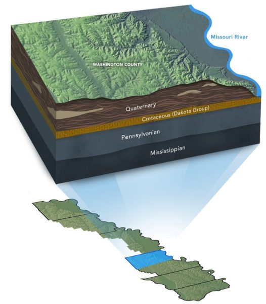
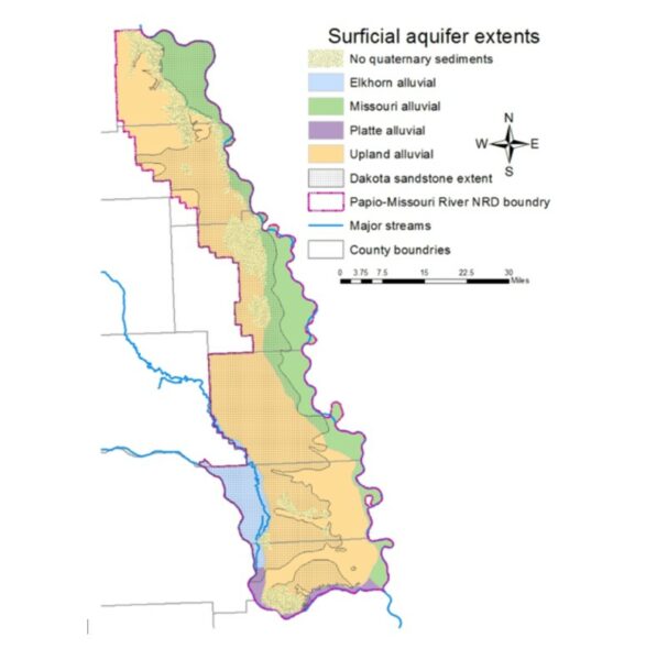
But first, what is groundwater, or what is an aquifer?  Groundwater is any water that is contained within the openings, or voids, below ground.  These voids are typically very small and only occur between soil particles, such as clay, silt, sand and gravel.  An aquifer is a geologic layer or strata of water-bearing material from which groundwater can be extracted.  Groundwater is usually extracted by pumping it from a well and the best producing aquifers in our area are found in layers of sand, gravel, and sometimes sandstone.  Our District has four primary aquifer systems: the Platte and Elkhorn River alluvium, the Missouri River alluvium, the upland alluvial or glacial deposits, and the Dakota Formation sandstone.

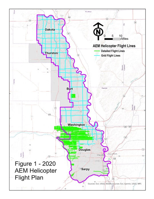
The Papio NRD has worked with the U.S. Geological Survey since 1992 to sample and test the groundwater from various aquifers throughout our District.  Today, this sampling is performed bi-annually from dedicated monitoring wells owned by the NRD across our six-county area.  Additionally, one of the four primary aquifers is selected each year and 20 to 25 samples are obtained (primarily from private domestic wells) and tested.

Water quality results are reviewed each year by NRD staff and our Board of Directors.  “For the most part, groundwater quality across the NRD remains good,” says Paul Woodward, Groundwater Management Engineer for the Papio NRD. “During the past several years, the NRD has reacted to low-level nitrate contamination concerns near Tekamah and Springfield by declaring Phase II Groundwater Quality Management Areas.  These Phase II areas calculate and track nitrogen fertilizer applications as well as implement other best management practices,” says Woodward.

Results from the groundwater quality testing are made available through the USGS National Water Information System at https://maps.waterdata.usgs.gov/mapper/index.html.

For local cities and public water systems, groundwater quality is sampled and tested in accordance with the Nebraska Department of Health and Human Services.  Anybody can access water quality testing data for municipalities or Rural Water Districts by going to https://sdwis-dhhs.ne.gov/. Every person has the ultimate responsibility to research and understand how the quality of the water you use may affect your health.  In areas where no public data is available, especially for private domestic wells, it is recommended that each home and well owner have their well sampled and tested each year, primarily for bacteria and nitrates.

The Papio NRD offers assistance to private landowners who need help sampling and testing their domestic well.  If you need information or even test kits, you can contact Paul Woodward at 402-315-1772 or the Dakota City field office at 402-494-4949, Extension 3.


Helicopter to Make Low-Level Flights Starting August 1st

Flights to Collect Data About Groundwater Aquifers

Data-collecting helicopter equipment

Eastern Nebraska residents should not be alarmed if they see a low-flying helicopter over areas of the Papio-Missouri River Natural Resources District in August.

Beginning August 1st and lasting approximately three weeks, instruments mounted below a helicopter will collect and record geologic measurements to learn more about groundwater aquifers in Dakota, Thurston, Burt, Washington, Douglas, Dodge and Sarpy Counties. The Papio NRD, as part of the Eastern Nebraska Water Resources Assessment, have planned the flights and are completing them with financial assistance from the Nebraska Water Sustainability Fund, through the Nebraska Natural Resources Commission. A flight schedule for each area is forthcoming.


“The flights will improve our understanding of available groundwater and its possible connections with surface water in an area of the state made more complex by the presence of glacial deposits,” said Paul Woodward, Groundwater Management Engineer for the Papio NRD.

Aqua Geo Frameworks (AGF), of Mitchell, Nebraska will oversee the flights, process data and produce a final report. The equipment can collect data at a speed of more than 50 miles per hour and explore to a depth of more than 700 feet below the ground surface. Scientific equipment, that looks like a hexagon, is towed about 100 feet below the helicopter in a ‘spider web’ array and is designed to map geologic structures beneath the surface of the earth. The helicopter will be manned by experienced pilots specially trained for low-level flying with this equipment.

The flights are a continuation of previous data collected during 2016 and 2018 and will provide a geologic understanding of all remaining areas in the Papio NRD.  Similar flights have been made across Nebraska since 2007 as NRDs seek to better understand and manage groundwater resources.


Low-Flying Helicopter – Not to Alarm Public

The Papio NRD and ENWRA (Eastern Nebraska Water Resources Commission) have low-flying helicopter flights taking place in late June and July over Eastern Nebraska to collect and record geologic measurements to learn more about buried aquifers. We want to public to be aware so they will not be alarmed if they see a helicopter mounted with instruments in their area.

Below is a news release from ENWRA with more information.

Eastern Nebraska residents should not be alarmed if they see a low-flying helicopter over areas of the Papio-Missouri River Natural Resources District (P-MRNRD) in June and July.

Beginning in late June and lasting approximately two to three weeks, instruments mounted below a helicopter will collect and record geologic measurements to learn more about buried aquifers (glacial sands and gravels, sandstones and other water-bearing materials).  The P-MRNRD and other members of the Eastern Nebraska Water Resources Assessment (ENWRA), a coalition of six NRDs in the eastern third of Nebraska, have planned the flights with help from the Nebraska Water Sustainability Fund, through the Nebraska Natural Resources Commission.  According to Katie Cameron, coordinator of ENWRA, “The flights will improve our understanding of available ground water and its possible connections with surface water in an area of the state made more complex by the presence of glacial deposits.”

Aqua Geo Frameworks (AGF), of Mitchell, Nebraska will oversee the flights, process data and produce a final report.  The equipment can collect data at a speed of more than 50 miles per hour and explore to a depth of more than 700 feet below the ground surface.  The helicopter will fly over parts of Dakota, Thurston, Burt, Washington, Douglas, and northwestern Sarpy Counties within the P-MRNRD.   Cameron said the flights will be a continuation of ENWRA flights conducted during summer 2016 and will focus with more detail on several areas within the P-MRNRD.  Scientific equipment is towed about 100 feet below the helicopter in a ‘spider web’ array and is designed to map geologic structures beneath the surface of the earth.  The helicopter will be manned by experienced pilots specially trained for low-level flying with this equipment.  Similar flights have been made across Nebraska since 2007, according to Cameron, as NRDs seek to better understand and manage ground water resources.

For more information, please contact:

Contact:
Katie Cameron, PG
UNL Survey Hydrogeologist / ENWRA Coordinator
PH: (402) 476-2729

PH: (402) 419-4798 cell
kcameron_enwra@lpsnrd.org
www.enwra.org


Public Hearings for New Groundwater Management Plan

Three public hearings are scheduled across the Papio-Missouri River Natural Resources District (P-MRNRD) to gather community feedback on the District’s new Groundwater Management Plan.

The current P-MRNRD Groundwater Management Plan for the six-county NRD area including Sarpy, Douglas, Washington, and Dakota Counties plus the eastern portions of Burt and Thurston Counties in Nebraska, acknowledged a lack of existing information about groundwater quantity and quality. Since 1994, P-MRNRD has gathered a significant amount of hydrogeologic information on the distribution of groundwater aquifers across the district. Furthermore, with over 30 years of groundwater monitoring data, information on specific areas within the district with water quantity and quality issues have been identified.

Topics to be discussed at the public hearings include:

– Who would be affected?
– Proposed rules and regulations
– What are the benefits of the new plan?
– What would change?
– What portions of the District may be designated as a Groundwater Management Area?

More than 750,000 people live in the Papio-Missouri River NRD area and many rely on clean groundwater as their drinking water supply, for irrigation, and various industrial uses. The new Groundwater Management Plan has been prepared with more recent data, as well as input from stakeholders across the District who represented groundwater users in the NRD. The new Groundwater Management Plan is expected to replace the existing plan.

Public Hearings

The public hearings in Dakota City, Tekamah, and Omaha are scheduled as follows:

  • November 30, 2017 @ 6:30 p.m. – Dakota City Field Office, 1505 Broadway, Dakota City, NE
  • December 7, 2017 @ 6:30 p.m. – First Northeast Bank of Nebraska, 2nd Floor Conference Room, 448 South 13th Street, Tekamah, NE
  • December 14, 2017 @ 7:00 p.m. – Natural Resources Center, 8901 S. 154th Street, Omaha, NE
Top