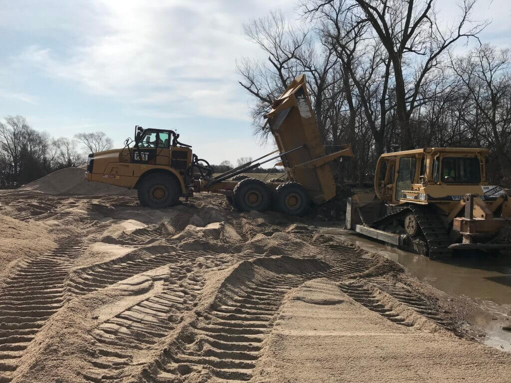
The Papio-Missouri River Natural Resources District will close all access sites to the Elkhorn River for the season on November 1st. The access sites include Elkhorn Crossing, West Maple Road, and Graske Crossing.
Flights to Collect Data About Groundwater Aquifers
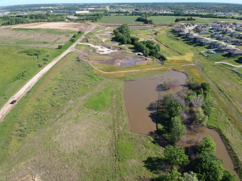
Data-collecting helicopter equipment
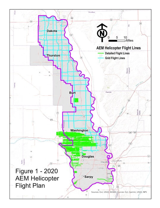
Eastern Nebraska residents should not be alarmed if they see a low-flying helicopter over areas of the Papio-Missouri River Natural Resources District in August.
Beginning August 1st and lasting approximately three weeks, instruments mounted below a helicopter will collect and record geologic measurements to learn more about groundwater aquifers in Dakota, Thurston, Burt, Washington, Douglas, Dodge and Sarpy Counties. The Papio NRD, as part of the Eastern Nebraska Water Resources Assessment, have planned the flights and are completing them with financial assistance from the Nebraska Water Sustainability Fund, through the Nebraska Natural Resources Commission. A flight schedule for each area is forthcoming.
“The flights will improve our understanding of available groundwater and its possible connections with surface water in an area of the state made more complex by the presence of glacial deposits,” said Paul Woodward, Groundwater Management Engineer for the Papio NRD.
Aqua Geo Frameworks (AGF), of Mitchell, Nebraska will oversee the flights, process data and produce a final report. The equipment can collect data at a speed of more than 50 miles per hour and explore to a depth of more than 700 feet below the ground surface. Scientific equipment, that looks like a hexagon, is towed about 100 feet below the helicopter in a ‘spider web’ array and is designed to map geologic structures beneath the surface of the earth. The helicopter will be manned by experienced pilots specially trained for low-level flying with this equipment.
The flights are a continuation of previous data collected during 2016 and 2018 and will provide a geologic understanding of all remaining areas in the Papio NRD. Similar flights have been made across Nebraska since 2007 as NRDs seek to better understand and manage groundwater resources.
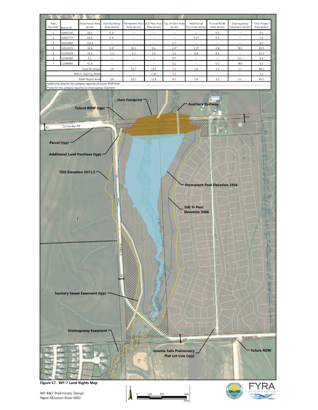
The Papio-Missouri River Natural Resources District Board of Directors today voted unanimously to name Papillion’s new flood mitigation reservoir Big Elk Lake in honor of Chief Big Elk, a principal leader of the Omaha tribe.
Chief Big Elk was a leader of the Omaha tribe on the upper Missouri River where we live now,” said Papio NRD Director Kevyn Sopinski, who represents Subdistrict 10. “Big Elk played an important role in Sarpy County history and naming this flood mitigation reservoir after him is a meaningful way to not only commemorate the historical imprint Big Elk left, but keep it alive by educating others on this great leader’s life, death, and all he accomplished in between,” said Sopinski.
The Papio NRD Board of Directors agreed with Sopinski’s name proposal and today voted during its June board meeting to name the new Papillion reservoir (previously referred to as WP7), located near 108th and Lincoln Rd., Big Elk Lake.
Dr. Rudi Mitchell, the great-great-great grandson of Chief Big Elk, said he was very pleased when he heard the Papio NRD Board planned to recognize his ancestor.
“There is currently no tribute to Chief Big Elk in Omaha, said Mitchell. “Big Elk was admired for leading one of the most peaceful tribes through many challenges. Through his speeches, trading, and peace treaties, Big Elk had a gift for peacefully bringing settlers and the Omaha tribe together,” said Mitchell. “This says a lot about the kind of leader he was and I’m grateful he will be remembered in an area of beauty and nature.”
While the new reservoir’s primary purpose is to help protect the lives and property of citizens from floods, it will also feature recreational amenities, such as a 40-acre park, 12½-acre lake, walking/cycling trails, kayak/canoe launches, picnic shelter, and fishery enhancements.
The project is estimated to open in late spring/summer of 2021.
The public is invited to provide input on the proposed name of Big Elk Lake for a new flood mitigation reservoir (currently referred to as WP-7) at the Papio NRD Board of Directors meeting on June 11 at 4:00 p.m. Any input is accepted until formal action is taken by the Board at the June meeting.
The new reservoir is located in Papillion near 108th and Lincoln Rd. It will will feature a 12½ acre lake and recreational amenities, such as trails, kayak/canoe launches, picnic shelters, and fishery enhancements. The project is estimated to be completed September 2020.
In coordination and cooperation with Nebraska Game and Parks Commission and local partner agencies, the Papio NRD will open tent and RV camping at Elkhorn Crossing on Saturday, June 6th. All social distancing and Directed Health Measures must be adhered to by all park users. If an inordinate amount of violations occur, the Papio NRD will reevaluate the situation and reimpose restrictions as necessary.
Updated May 28, 2020
In consultation with the City of Omaha and other partner agencies, the Papio-Missouri River Natural Resources District will open playgrounds, picnic areas, and restrooms at Papio NRD operated and maintained recreation areas on June 1st. The Douglas and Sarpy county parks include Chalco Hills Recreation Area, Prairie View Recreation Area, and river access sites.
The status of Papio NRD recreation areas are as follows:
Douglas County
All River Access Sites along the Elkhorn & Platte Rivers
Hours – 6:00 am to 10:00 pm
OPEN:
Playground equipment
Picnic areas
Restrooms
Parking lots
Campsites at Elkhorn Crossing (tent and RV camping)
The recommended social distancing of six feet is still required between park users.
Prairie View Recreation Area
Hours – 6:00 am to 10:00 pm
OPEN:
Trails
Prairie View Lake
Boat ramps
Parking lots
Playground equipment
Picnic areas
Restrooms
The recommended social distancing of six feet is still required between park users.
Sarpy County
Since Chalco Hills Recreation Area is located in Sarpy County, the Papio NRD coordinates with all of its partners in Sarpy County to ensure it is following the same guidelines in order to protect public health while simultaneously providing its constituents a safe recreational outlet.
Chalco Hills Recreation Area
Hours – 6:00 am to 10:00 pm
OPEN:
Trails
Wehrspann Lake
Boat ramps
Parking lots
Playground equipment
Picnic areas
Restrooms
The recommended social distancing of six feet is still required between park users.
The Papio NRD will update any changes to the status of these recreation areas here on its website.
Papillion Creek Watershed Supplemental Plan – Environmental Assessment
Due to the uncertainty involved with the COVID-19 virus and public health developments, the Papio NRD and Natural Resources Conservation Service (NRCS) are going to cancel the scheduled open house. However, your feedback is important to us.
Beginning on March 23, the planned presentation will be available on our project website: https://trello.com/b/I2bEEIiB/papillion-creek-watershed-supplemental-plan-ea
Site locations and preliminary designs have been developed for the seven sites proposed in Douglas, Sarpy and Washington Counties and information on each site will be detailed in the presentation. The projects are intended to develop solutions for watershed issues such as erosion, floodwater and sediment damage, water quality and habitat improvements, and others.
The project team including the P-MRNRD, NRCS, FYRA Engineering, and Olsson Associates will do our best to accommodate requests for information and are willing to send information by mail, email, etc. Please reach out with any comments or questions to Amanda Grint, Project Manager. You may reach me by email at agrint@papionrd.org or phone at 402-315-1722. You may also send comments to my attention at Papio-Missouri River Natural Resources District, 8901 South 154th Street, Omaha, NE 68138. Please provide comments by April 6th.
To help keep residents who live near Union Dike informed of the status of the levee’s rehabilitation, the Papio-Missouri River Natural Resources District is providing a project timeline.
Union Dike is located on the east bank of the Platte River between Valley and Fremont, Nebraska. The US Army Corps of Engineers (USACE) and the Papio NRD are working together to repair 2019 flood-damaged areas caused by overtopping of the dike and high water along both sides of the dike.
The USACE is handling the following tasks:
Prepare project repair plans
Hire a contractor to complete the dike repairs
Administer/inspect the repair work
The Papio NRD will provide soil for the repairs and reimburse the USACE 20% of the construction costs.
The tentative Union Dike project timeline is as follows:
USACE advertise project for bids – March 12, 2020
USACE open bids – March 26, 2020
USACE give contractor Notice to Proceed – April 30, 2020
Completion Date (120 days from Notice to Proceed) – August 28, 2020
It should be noted, the project schedule is contingent on receiving acceptable bids and suitable construction weather.
During the Papio NRD board meeting on December 12, 2019, independent auditor, berganKDV, gave the District a clean financial bill of health in its FY 2019 audit report.
The full report, along with Papio NRD financial statements and supplemental information, can be found here.
It’s the beginning of fiscal year 2020 for the Papio-Missouri River Natural Resources District and the District has a double-dose of good news for local taxpayers.
Decrease In FY 2020 Property Tax Levy
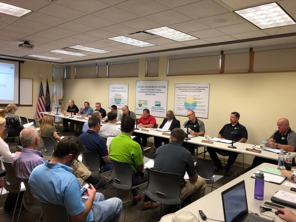
The Papio-Missouri River Natural Resources District Board of Directors last night voted to approve the Fiscal Year 2020 general operating budget that called for a decreased property tax levy of .037384 per $100 of assessed valuation. This means a homeowner with property valued at $100,000 would pay a total of $37.38 in property taxes next year to support NRD projects.
Papio NRD Board of Directors
“We are proud to announce the District’s property tax levy will decrease again this year,” said John Winkler, general manager of the Papio NRD. “For 14 out of 15 years, the District has either decreased or kept the tax levy the same. Practicing fiscal responsibility – working strategically and creatively to save taxpayer dollars is our civic duty. We take it very seriously,” said Winkler.
The budget calls for an estimated $26 million in revenue from the NRD’s property tax levy. The total operating budget is estimated at $70.5 million.
The Papio-Missouri River NRD’s property tax levy amounts to less than two percent of the total property tax bill for residents living within the District’s six-county area. The levy is based on an estimated 6.86 percent increase in valuations across the District.
Refinancing of Bonds Saves Taxpayers $1.8 Million
Due to the refinancing of 2015 and 2017 Flood Control Protection and Water Quality Enhancement Refunding bonds, the Papio NRD is expected to save District taxpayers $1.8 million over the remaining term of the bonds.
In addition, over the past four years, the District refinanced its 2010 bonds, saving taxpayers $3.5 million, to date.
“Complementing this good news, S&P Global Ratings recently assigned an upgraded ‘AA’ rating to the Papio NRD,” says Winkler. “This will produce additional savings not only during the refinancing of bonds, but also in the future as the District continues to provide flood control and water quality to our District.”
The Papio-Missouri Natural Resources District includes all of Sarpy, Douglas, Washington and Dakota counties, plus the eastern 60% of Burt and Thurston counties.