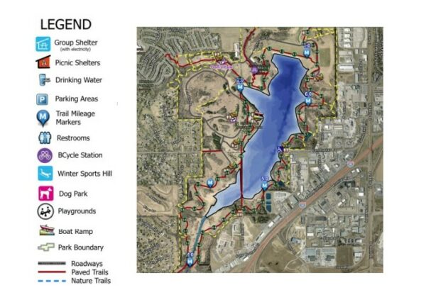
Coming to Chalco Hills Recreation Area? Our new interactive park map not only enables you to explore and navigate all the amenities on your mobile phone, but also includes the ability to locate yourself in the park and see mile markers along the trails – two important safety features.
If you prefer to physically hold a map, we’ve got you covered with this print map you can download or pick up at several locations around the park, including the park’s main entrance.
Park amenities/features the maps help you easily locate include:
- Trails (paved and nature)
- Trail mile markers
- Picnic shelters
- Accessible fishing pier and picnic area
- Drinking water
- Restrooms
- Parking areas
- Playgrounds
- Boat ramp
- Lake depths
- Dog park
- BCycle station
In addition, boaters and anglers can find lake contour maps of Wehrspann Lake and Prairie View Lake here.
We hope these maps help make your recreation experience here at Chalco Hills even more enjoyable.
We look forward to seeing you!